Let me preface by saying that I’m not the L.L. Bean poster child. I’m a Slacker Packer. Until last October, my longest camping excursions were music festivals, where a burrito cart was always a stone’s throw away. Actual hiking? Here’s a timeline of my serious attempts at the rugged outdoor life, up to now.
1998: Camped in a flood diversion channel, somewhere near Athens, Georgia. In the morning, a flash flood swept all of us away, still in our sleeping bags.
2001: Rainbow Falls, Washington. Plenty of rain, but no sign of the falls or rainbows. Naturally, the weather improved immediately after we finished packing the tents two days later.
2007: Excursion to Hell Swamp, South Carolina. Got lost. Possibly met the Blair Witch. Never found the swamp.
2011: Bike ride up the Malay Peninsula. Actually, that was a pretty good experience, even if the tent only came off the bike once during the entire three weeks. Hotels are nicer.
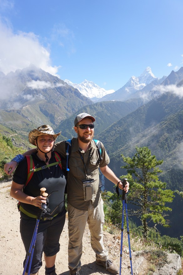
All my hikes have been low energy one-day jaunts. All my camps have been on tailgates, well-equipped with coolers, kitchen appliances, and other modern amenities. When my old pal Greer suggested we hike the Himalayas, I had some apprehensions.
I’m not a mountaineer. I don’t tie knots, I don’t own an ice axe, I cannot tell you the difference between a crampon and a cramp-off. Then again, I’ve known people here — some of them well out of shape — who’ve done Everest Base Camp and survived. I eat reasonably well, I walk to work, I do yoga. I probably drink more beer than the average outdoorsman, but how hard can the Himalayas be?
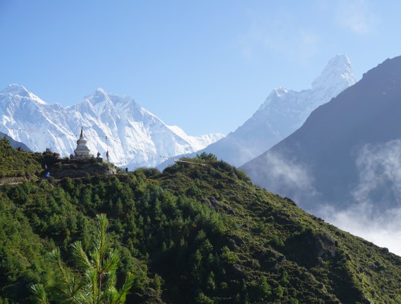
Greer booked her flight, and we got down to planning the details. A good friend shared with me the itinerary he and his wife used the year previous. About one full week to get up, three to four more days to come back down. Originally, Greer was thinking Everest Base Camp, but after I spoke with a few seasoned hikers, they all recommended the Gokyo Lakes instead. The problem with EBC, they say, is you don’t see much of Everest because you’re on Everest. However, there’s an amazing view of the peak from Renjo La Pass, which incidentally, is the same elevation as EBC.
There were a few other details that had to be negotiated. Greer wanted a porter. A porter? Come on, I argued. Porters are for lazy, terrible people. We are rugged. We are strong. She said that I was welcome to carry my bag, but she’d hire a porter. Eventually, I saw the wisdom of her argument. Given a choice between spending $17 a day, or carrying my belongings up 3.3 vertical miles, I opted for practicality over pride.
She also wanted oxygen. Oxygen? There’s plenty of oxygen there. In the air. Granted, far less oxygen than at sea level, but we won’t need oxygen. I’ve talked to a million people who’ve done this hike a million times. They say we don’t need oxygen, and oxygen is a terrible idea because it comes in big heavy tanks that people just leave up there.
“We’ll have the porter carry it. I want oxygen.”
Here’s the thing. Once you advance past Camp One, that’s when you need to pack oxygen. Not at any time before — unless you happen to be suffering from altitude sickness, and at that point, you’re probably coughing up blood anyway, so good luck, pal. But Greer wouldn’t have it. She’s a classic Taurus, and by that I mean she is stubborn and reads too deeply into horoscopes. I love that about her.
Then she called me one afternoon to say we wouldn’t need oxygen after all. She’d met someone who’d hiked the Himalayas, and they told her don’t worry about oxygen. A face palm moment.
The weeks leading to her flight passed quickly. I was so excited to receive my old friend in Kathmandu, I came to the airport a day early. Also, I’m very bad with calendars, especially when I fail to notice the (+1) next to flight arrival times.
On the evening she actually arrived, we celebrated with a late night bite at my favorite curry place. In the days leading to the trek, we managed to knock out a few Kathman-must-do’s, from a lunch at Boudhanath to a barbecue at my buddy Suraj’s shop (one of those is a UNESCO site, and the other one should be). We wandered around the Thamel backpacker district, picking up our park passes and dropping by Shona’s Alpine to rent and purchase needed gear.

Monks at Boudnath

Crowded streets of KTM

Standstill traffic, pretty typical
Early Sunday morning, the real adventure began. At the domestic terminal of KTM, we encountered a few packs of people I know, all of them headed to different outdoorsy destinations around the country. A tiny part of me was a little envious; couldn’t we just spend a week relaxing by the lakes in Pokhara, or by the lazy rivers of Chitwan? No, we had bigger things to do. Greer and I boarded a tiny two-engine plane with about 20 other hikers and took off for Lukla.
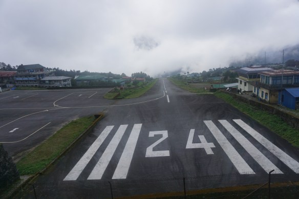
The flight is an adventure in itself. It’s like a roller coaster ride, except it might actually kill you. The plane strafes the treetops of mountainous pine forests, struggling against randomly quarreling jet streams, its twin props heaving like an emphysema ward. Then there’s the landing at Tenzing-Hillary Airport. Year after year, this airport maintains its proud position on the “World’s Most Dangerous Airport” lists from travel magazines, engineering journals, and news outlets. The runway is just over 1700 feet long, and slanted upwards to help slow landing aircraft. Due to heavy fog and unpredictable weather, flights from Kathmandu to Lukla are frequently cancelled in the later morning, but some end even sooner than that… on the side of a mountain.
Highway to the Danger Zone
Fortunately, we booked an early morning flight and arrived to Lukla with no incidents. We also had no porter, but there were plenty of folks happy to take on the job. We got a young sherpa by the name of Nopraj. Nopraj spoke no English, except for “We go now, slowly-slowly.” I’m not convinced he was great with maps either, because while we had pinned the different villages where we planned to stop, he definitely had his own itinerary. In some ways, that was better.
Our first stop, Phakding, is Nopraj’s home village. We got to meet his uncles, brothers, and cousins. All of them were guides and porters as well, so we’d continue to see them at different parts of our trek. They appreciated a hearty pitcher of chyang, my Nepali alcoholic beverage of choice. Phakding is also where we started to feel the initial side effects of Diamox, an altitude sickness medicine: it makes beer taste terrible. It tastes like someone left the can open in the sun, behind a latrine, for a year, then resealed it. At first I thought that’s just how Nepali Ice tastes sometimes, but we compared with different cans in different towns, and the same result each time. We’d discover many other exciting side effects in the days ahead.
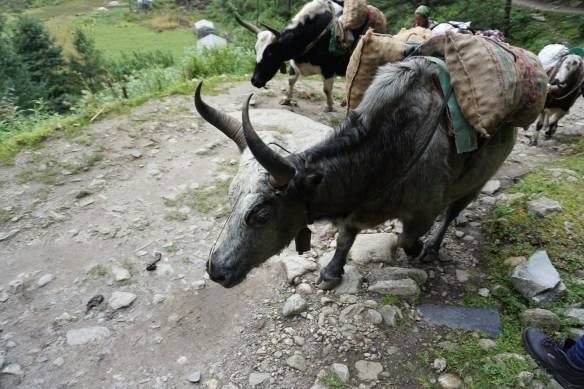
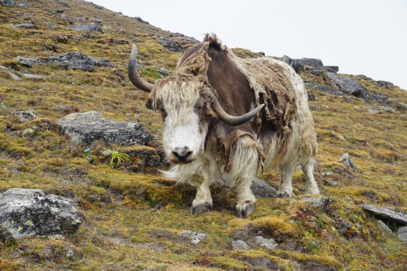
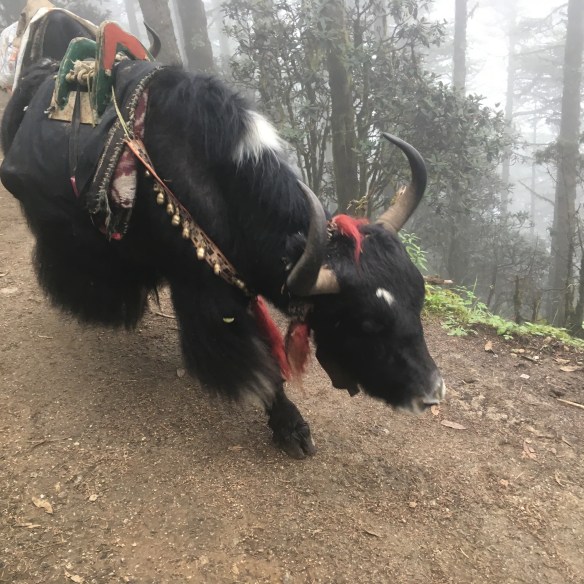
Jorsale was a nice stop. Our tea house overlooked the river. We sipped on mint tea and watched the yak caravans pass, with their ornately decorated saddles and awkwardly swaying cargo, tin bells clanging all the way. At this point, we hadn’t done any notably strenuous hiking, and we already had views of Amadablam, a particularly angry-looking Himalayan peak. At this point, there had been virtually no change in altitude since Lukla — 9,200 feet and going strong!

Enjoying a cuppa with Nopraj
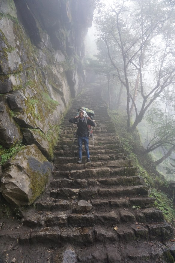
Namche Bazaar was a brutal wake-up call. It was like hiking straight into a wall — a kilometer-high wall. That’s three football fields tall, for my American friends. One minute, we’re walking along a peaceful meandering river, next minute, the trail shoots straight up. From there, a shaky steel suspension bridge connects one stone precipice to the next, a few hundred feet above the not-so-peaceful-anymore river. Even after that come many more punishing hours of walking pretty much straight up into the sky, sometimes having to share space with EBC hikers trying to Instagram while on foot, or trains of donkeys who will totally knock people off cliff-sides because they’re total asses.

The bridges behind us
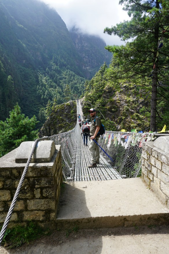
The crossing
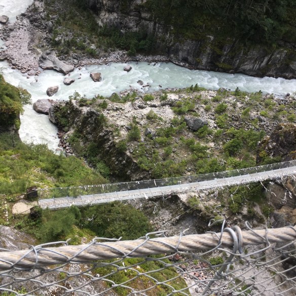
The drop
Sweet reprieve as we reached the ranger station just outside Namche. They checked our park passes and asked Nopraj where we’d stay that night. He replied, “The Hilton.”
Maybe it was the low oxygen taking hold, but that was the funniest thing I’d heard all week. I started laughing like a crazy person, high-fiving Nopraj for his sudden sense of humor. Except he was serious. We were staying at the Hilton.
Except we weren’t staying at the Hilton. We stayed at the Hill Ten. The name is an amalgamation of Sirs Edmund Hillary and Tenzing Norgay, the first people to summit Everest. And it was definitely no Hilton.

Not a Hilton. Not by a long shot.
Not only did the manager refuse to acknowledge my Hilton Honors Gold status, he also balked at my question about dining at other restaurants in Namche (it only takes a few days for rice-and-veg dal baht to become tiresome). He grunted something about extra fees we’d pay if we ate any meal at any place other than the hotel, and how lucky we were to even have a room. I immediately started to question Nopraj’s judgement in fine hotels.
To make matters worse, Greer succumbed to altitude sickness that night. Exhaustion, vomiting, disorientation, the whole nine. To his credit, the hotel manager wound up being a real star. He made her some special garlic soup, meant to alleviate symptoms, and checked in on her progress regularly. For that reason, and because we didn’t feel like packing bags again, we stayed at the Hill Ten for two nights, so we could acclimatize and recover.
Greer felt better the next day, so we set out to explore Namche Bazaar. It’s a small place, packed with backpacker lodges, gear shops, and souvenir vendors. I considered picking up a Gokyo Ri patch, then going home, but Greer would never let me get away with it. However, we did pick up a piece of equipment that would prove incredibly valuable later on: a solar-powered battery charger. I thought at first it was a rather impulsive way for Greer to spend a hundred dollars, but she’d noticed all the tea houses, even the luxurious Hill Ten, demanded crazy amounts of money to charge guests’ devices. Between us we had an SLR camera, two cell phones, and an ultraviolet-light water purifier. I supposed it made sense, especially if it made her feel more secure about having access to her Android. As it turned out, that solar panel would save more than just money.
We opted for a sneaky pizza at the Irish Bar (yes, there’s one in every town) and were attempting to share a skunky beer when we met a strange backpacker whom I’ll refer to as Mitch Hedburg. Not because he’s funny like the comedian, but because he has some real neurotic stuff going on, and he drowns it in alcohol, and he talks in a stream of consciousness.
This Mitch was from the brilliant state of New Jersey, and represented his people well. He told us he’d spent the last few weeks in Namche because it’s a total party (it’s not), the drinks are cheap (they aren’t), and he was banging backpacker chicks left and right (I’m sure he wasn’t). He was kind enough to start puffing away at a hookah as soon as our pizza arrived. We left him at the bar, and he managed to drag another trekker group into his world of nonsense.
At some point, Greer went up to the Hill Ten for a nap, and I wandered around the town a bit more. Walking up a set of stone steps, I noticed my legs grew heavy and my head started to spin. I sat down to pull it together. A few moments later, I felt better and took another few steps. This time I went down pretty hard. An elderly couple noticed me, and brought out some water. I think they wanted me to stick around for mint tea but I had to get to my bed. These were altitude sickness symptoms.
Here’s what I did not know about acute mountain sickness, or AMS. Firstly, pretty much everyone gets it above 8,000 feet, whether you’re a first time hiker or Richard Branson. Second, AMS impacts different people different ways, even people who ascend slowly with lots of rest stops, like we did. A mountain clinician described it this way: first you feel hungover, then drunk. Some folks might only feel shortness of breath or a slight headache. Other people will completely shut down, and earn themselves a one-way helicopter ride to the international clinic.
Let me tell you, there were lots of helicopters buzzing past on this trip! Yes, some serve as supply lines to high villages, but most of them are evacuating poor saps who don’t read the early warning signs of AMS, and power forward. Maybe it’s pride: “If I don’t come back with a Base Camp selfie, what will my friends think?” Maybe it’s time, or money: “These are the only two weeks I could get away from the office, and I spent a freaking fortune on the flight and the guide and all this gear… do I even need an ice axe?”
For me, the symptoms came on as total exhaustion. I did eventually get to bed, then it was Greer’s turn to make sure I didn’t die in my sleep. Fortunately, by dinner time, my strength had returned, but I ate a yak steak just in case.

As the altitude sickness passed, so did the cloud cover.
Even more fun than AMS symptoms is Diamox side effects. After a few days on these drugs, some really crazy shit starts to unfold. For one thing, I had to pee… like, all the time. It has something to do with the chemicals kicking your endocrine system into high gear. Diamox also makes the tips of your fingers and toes go numb, which I’m sure really messes with people at Base Camp altitudes, who cannot tell if it’s Diamox side effects or frostbite.
Most intriguing of the side effects? The dreams. Totally lucid, but hauntingly surreal dreams. I dreamt of driving a Katmandu taxi through a Disney-themed bridal parade with my college pal Brooke in downtown Portland. No one has yet been able to explain why this drug stirs up lucid dreams, but it sure was amazing. Sometimes I think about spending a leisurely week on Diamox just to enjoy the dreams again.
Here’s something that everyone says on this trail: “You’re through the worst of it now.”
That is a lie.

At least there’s no more ant lines after you clear Namche.
People coming down the trail from Namche swore that things got easier, further north. The morning we set off for Phorste Tanga, I was pleased to see it was such a short distance on the map, and only a 700 foot ascent. But once again, it was straight up into the damn sky, totally unrelenting.
Have I mentioned that Nopraj is my hero?
The stone staircases now resembled something more like ladders. But the views were amazing. Probably the best of the whole trek. We were now at a vantage point where we could see many of the Himalayan giants.

Just peeking out at first…

There they are

My Zissou pose

Cool lichens
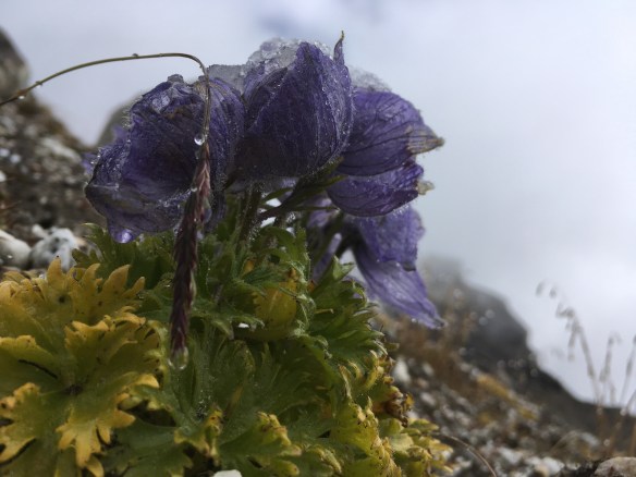
Lovely flowers

Action man!
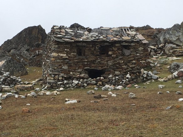
Along the way, we passed a sort of ghost village, full of old vacant stone houses. We got dusted by some local Sherpa kids bounding up the boulders, collecting yak dung (so much dung) into giant baskets strapped to their heads. They were having a blast, it was like a game for them. Beat the Foreigners up the Mountain, with free dung tokens all the way.

Site of a ghost village

My brother and I had slightly different kinds of chores growing up.
We also met a Frenchman, beret and all, who was heading down. He told us he did this hike every few years, and it was his favorite in the world. He began to tell us it got easier after Phorste, but we knew better.

The many lodges of Khumbu


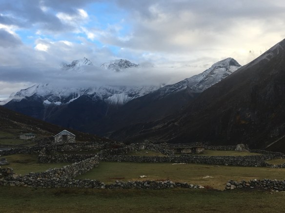
We booked into the Alpine Cottage Lodge, a peaceful, cozy place. Nothing around us except bird songs, and the gentle clanging of yak bells. About this time, we got to know a couple whom we’d seen on trail at a few rest stops. They were Québécois, and super friendly. We came to learn that their guide had taken on our porter as an apprentice, and he was essentially now calling the shots about where we would stay. That sounded fine, since their guide seemed to be more experienced.
Yaks!


The next leg would be the longest of the trek: Machhermo. Unlike other legs that ranged from four to six hours, this one went on pretty much all day, and it ascended 2,600 feet. At this point, I started to reflect on some of the everyday routines of trail life:
- adjusting my hiking poles, constantly
- tying my boots, constantly
- urinating, constantly
- fresh mountain air interrupted by the occasional waft of manure or dead things
- learning new card games from locals and foreigners
- snot rockets
- acute awareness of the many ways to die
- alternating between collecting MOOP, and no longer giving a damn
Slowly slowly we go
Possibly my favorite photo

So many ways to buff it up.

Varying stages of buff wear
I thought about my ancient ancestors, how they were tied to the land and the weather. If it rained, I got rained on. No two ways about it. No shelter to hide in. Just get wet. Snow? Get cold. Rock slide? Get buried in rocks.
I also noticed how wrecked my body was. We assume when we see intrepid hikers in National Geographic, that they’re the embodiment of good health. Not so. Altitude does a number on the old meat wagon. Probably didn’t help that I was battling my latest bout of giardia, which meant a daily dose of three kinds of antiparasitics and antibiotics, as well as iron and zinc supplements, in addition to that goofy little drug, Diamox. If the giardia was running high that day, I would also take an Imodium and hope to god that it’d last to the next squat toilet. Worst of all, I learned that caffeine can exacerbate AMS symptoms, so that meant no morning coffee, which makes for a Grumpy Sam (just as well… Nescafe is coffee that’s given up on life).


Approaching a full week on trail, above 8,000 feet, I could feel things inside me breaking. My nose was running like a spigot, my feet were swollen, my muscles threatened to go on strike, and every time I coughed into my hanky, I looked for blood. My thoughts were becoming driftier each day. At the start of the trek, I’d run short of breath after a long ascent. At this point in the trek, I ran short of breath after brushing my teeth. My stomach ached from a constant diet of Tibetan fry bread, garlic soup, fried rice with green pepper sauce, and mint tea, all of which cost more than twice what one would pay down in the valley. I wanted a burrito truck so badly.
As for Greer and me, this was fast becoming a test of our friendship. Engineers get flustered when things don’t work, like her UV water purifier. Altitude and cold can cut battery life by half. Fortunately, as an engineer, she is always thinking five moves ahead, and you’ll remember her purchase of that solar battery charger back in Namche. Even still, charging took time, and we did not have an in-the-meantime backup plan for drinking water, save for buying bottles at a premium rate. Greer got pretty irate about that. The higher the technology, the greater the need for a backup plan.
I’m sure I was also a piece of work. Maybe Greer will detail this further in the comments.
In Machhermo, we arrived to a totally dumpy teahouse, not what you want after a full day’s hike. Unfortunately, we didn’t have a wealth of options. We probably got the least dumpy teahouse in the village, though the walls were literally cardboard. That meant we got to know our Québécois friends much better, whether we — or they — liked it or not. Proud to say, my French is now much improved.
It would be my first shower in days. By “shower,” I mean that I was in a corrugated steel shed, just large enough for an adult human. One of the staff would bring over a kettle of freshly boiled water, add it to a tank on top of the shed, then pour in cold spring water so I wouldn’t be blanched alive. There was a release clip inside the shed, and the water would come pouring out of a sprayer fashioned from the bottom of a plastic soda bottle. With the cold crisp mountain air outside, I’d say it was an invigorating experience, but nothing I’m in a hurry to repeat anytime soon.
Night fell and so began my first truly frigid night. The commons area resembled a caterpillar commune, everyone bundled into their sleeping bags, shivering as they slurped down gassy garlic soup. This would be the first and not last time, that I would ask our hosts to “please drop some more dung on the fire.”

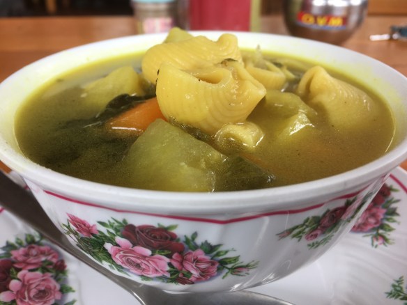
Sherpa stew. Basically 3 square meals in 1 bowl.
Finally the day came for the Gokyo Lakes hike. We’d ascend another 1,000 feet, but hey, I wasn’t expecting an easy hike by this point, was I? The high alpine flora was breathtaking, and as the trail went on, I saw the river turn deeper and deeper tones of aquamarine, indicating we were nearing the glaciers.

Just a quick jaunt. See trail left side of photo.


Made it!
We finished the short hike quickly, and we were at our teahouse in time for lunch. Sadly, this teahouse was not as appealing as the others in the village. Not many accommodations where you can say the view is actually shit. I mean it. Outside the window was a field of dung cakes, drying in the sun. When night fell, we were gathered in the commons area with our Québécois friends, shivering, sniffling, coughing, questioning the decisions we’d made that had led to this point, and the hosts denied our request to add more dung to the furnace.

Total shit
That night, I heard the Québécois through the walls again. They were plotting a coup. She wanted a nicer place. He did too. They’d either convince their guide to get a nicer place, or murder him. I looked across my room at the other bed — Greer had obviously been listening too. Her face said everything I was thinking. We should totally murder their guide. Or find better accommodations.


I consulted the itinerary my friend had provided me prior to the trip, remembering he’d recommended one particular place in Gokyo. The next morning, I scoped it out. It was closed for renovations, but the family owned another place next door that was also meant to be fantastic. Sure enough it was. Probably the closest thing to an actual Hilton at three vertical miles above sea level.
One very real concern however, was the porter meal. The way it works on trail is this: wherever the porter or guide takes his clients for the night, that place provides him with a bed and a giant helping of dal baht. Would a fancy pants place like this honor that agreement?
The answer was yes, absolutely. We were a little apprehensive breaking the news to our porter. He’d have to pack bags and also tell our dung house hosts that we were leaving. When we did tell him though, his face lit up. He assumed we were on a super tight travel budget, and wouldn’t be interested in a place that cost twenty whopping dollars per night. Not only would our man get a soft bed with clean sheets (note: sleep sack and pillowcase are a must on any teahouse trail), he would also have an entire menu to choose from, not just dal baht (he chose dal baht anyway). It was a win-win situation.

Nopraj!
Oh, the softness of that bed! Oh, the warmth of that dung stove! Oh, that lasagne, that lasagne, that lasagne!
I’ve had lasagne, plenty of times. I’ve had lasagne bolognese, lasagne florentine, and that bake-in-the-box stuff from Sam’s Wholesale Club. I’ve had lasagne in New York, Pisa, and Rome… you might say lasagne is an old favorite of mine. To quote the poetry of Ween, in their song, Roses are Free:
Eat plenty of lasagna ’til you know that you’ve had your fill
Resist all the urges that make you want to go out and kill
Advice to live by! But let me tell you, brothers and sisters. This lasagne was the best in the world. Sure, you might say that any lasagne would taste amazing after days in the wilderness with nothing to eat but sugars and empty carbs, but I say no. No, this lasagne was Divine. The noodles, soft and pillowy. The layers of sauce, a slow-cooked bolognese of ground yak. The up-top sauce, a perfectly prepared fresh béchamel. Oftentimes with lasagne, I eat halfway through the block, and get tired. Not the case here. I consumed what for me would be considered a double portion. And where I normally would’ve felt groggy and taken a nap afterwards, I suggested to Greer we attempt to summit Gokyo Ri. It’s just another 2,300 feet. I mean, we could see the top from the restaurant window. Didn’t look that high.
Full of vim and protein, we set off. It started off pretty easy, but here’s another thing about altitude: it makes everything really hard to do. Gokyo Ri looks like the kind of mound that, below 8,000 feet, I could summit in an hour or two. We crossed the river, and soon as the trail started going up, my body started to protest.
We must’ve been on that damn hill forever. We’d take eight steps, then stop for a break. Another eight, another break. We might go for a real marathon — ten steps — then require a break twice as long. Grazing yaks eyed us with mild pity.
I pity you, fool.
We might have actually summited Gokyo Ri had it not been for the weather. The last few days of our expedition, the weather routinely blew in hard and fast, right around noon. One minute, blue skies, and the next minute, we’re walking in a cloud with zero visibility. I’ve seen enough Everest films to know that weather is the big killer. Mama didn’t raise no fool. We were forced to turn around. Maybe next time, Gokyo Ri.

We did get to do some Zissou mugging before weather rolled in. Not the glacial scar along bottom of pic.

Also, Everest came out to play for a little while.
When we returned to the lodge, our Québécois friends were there. We shouldn’t have been surprised. This was the only Hilton-esque accommodation in a tiny mountain village. They planned to spend an extra day in Gokyo, whereas we planned to hike out early the next morning. We made plans to rendezvous in Kathmandu, and spent the rest of the day lounging lazily, reading books, playing cards, and watching helicopter evacuations from a commons area warmed by thick carpeting, double-paned windows, a massive iron stove. And the dung cakes kept on coming.
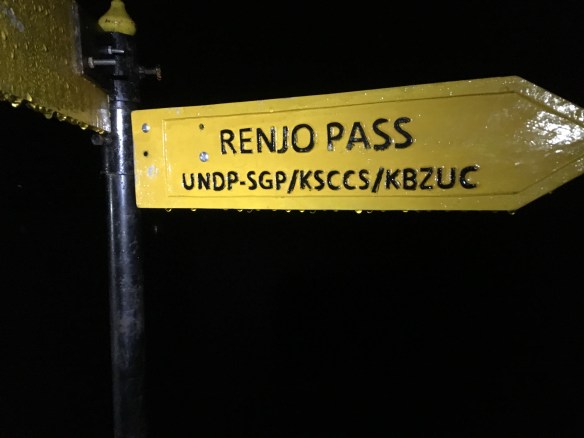
At 4:30am, Nopraj knocked twice on our thin plywood door, then let himself into the dark room, announcing himself with “Okay, we go now, slowly-slowly,” as he’d done every morning for the last week. Except this time, we were ready for him, with bags packed, water bladders filled, and batteries charged. We were ready for the high point of all high points, Renjo La Pass.
Here’s what we’d been told by trail guides and fellow hikers about Renjo La:
- It’s a pretty strenuous hike, but not nearly as punishing as what you’ve done already (lies!).
- Incredible views of the Himalayan range, including Everest.
- It’s mostly downhill from there.
Just as we’d done the day before, we crossed the narrow stone trail that cut through the stream. As we passed Gokyo Ri, we waved goodbye, and see you soon. It was still dark. Our headlamps lit the craggy path ahead. That’s when Greer’s flickered off.
At first, we thought we could continue with phone flashlights, but that quickly became impractical — you really need both hands to hike. One tiny miscalculation would have one or all of us tumbling hundreds of feet down a sheer face of granite. We set down the gear and Greer managed to find a freshly-charged set of batteries, buried in her pack. We were back on.
Oh good. So we’ll be in the dark.
WTH was I thinking?!

No, we aren’t halfway. We aren’t even a tenth of the way…
As the sun gently rose, it bathed the entire landscape in eerie purple and orange light, illuminating the ominous stony ladders ahead. As we ascended each switchback, we thought surely, it will level out soon. Sometimes it did, for a while.
Our first long rest stop overlooked the lakes and the surrounding goliaths, morning fog rolling down the slopes like river rapids. We drank hot mint tea and ate granola bars. Then another ascent.

Surely, there’s a ‘down’ soon?

Some angry looking tors there.
Totally bleak outlook
How does anything manage to survive up here?
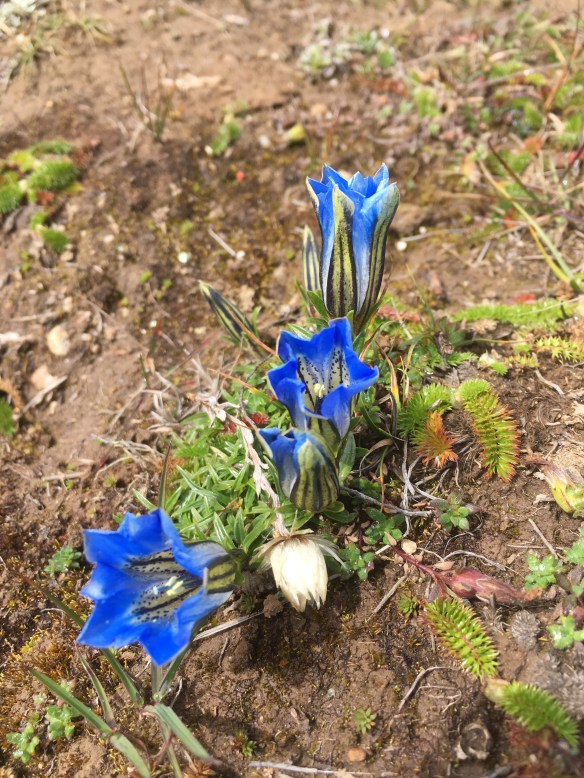
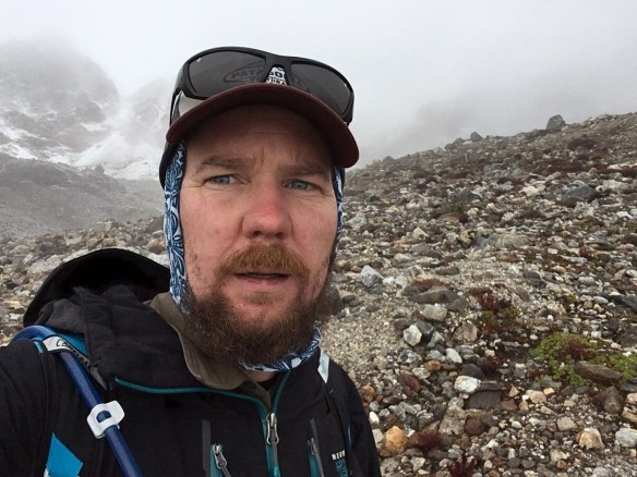
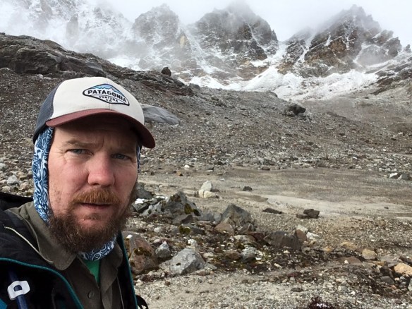
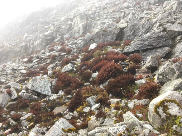
The next level opened up to a glacial morass. I love a good morass. Similar to the orogenic apocalypse I witnessed years ago in New Zealand’s Tongariro Crossing, the landscape was downright martian. Lovecraft-esque tors formed a corridor on all sides, colored with vivid tombstone blacks, rusted reds, and ancient grays, the ground occasionally dotted with optimistic purple and yellow flowers covered in hoary frost. Not a single sound up there, save for the thin layers of ice cracking beneath our boots like a sinister crème brulé.
Indeed, Lovecraft said it best in Mountains of Madness:

“I could not help feeling that they were evil things — mountains of madness whose farther slopes looked out over some accursed ultimate abyss. That seething, half-luminous cloud-background held ineffable suggestions of a vague, ethereal beyondness far more than terrestrially spatial; and gave appalling reminders of the utter remoteness, separateness, desolation, and aeon-long death of this untrodden and unfathomed austral world.”
Another ascent, and we could hear the glacier. This memory will haunt my dreams and nightmares for a lifetime. It was humbling, to walk alongside a solidly frozen river, the echoing knell as billions of tons of ice splintered and displaced billions of tons of ancient rock. It was a deafening reminder: this planet doesn’t give a damn about us puny apes.
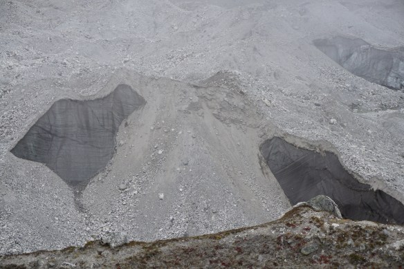
Glacier don’t care…
Another ascent, this one very slow. Word count tells me that I’ve used the word “vertical” a few times now, but this one took the prize. This was the y-axis of our trek. This ascent was less about stepping up, and more about scrambling up boulders, digging fingers into the crumbling stone, hiking poles strapped to our backs, loose gravel giving way with every upwards lurch. I no longer noticed the surrounding landscape. I was too busy forcing my lungs to cooperate with my heart and muscles. My skin became clammy yet cold. My face was red as road rash and my lips resembled the edges of a cheap leather wallet. I’m not normally one to pray, but on this occasion, I prayed to all deities East and West to please, please get me over this abominable pass. When we saw the Tibetan prayer flags flitting madly in the gales soaring over the precipice, I felt my invocation answered.

Oh good. Can we die now?
The top of Renjo La pass is a skinny piece of real estate, no more than eight feet across. On one side, we could see the brooding fog that surrounded the glacial horror-scape from where we had risen. On the other side, several hundred feet down, a wide open land surrounding a perfectly ovine lake, a gentle snow falling across the trail.

Check! Let’s go home now.

Oh look over at this side. More lake!
We had done it. Time to snap some selfies at 17,600 feet above sea level. Though we were a bit disappointed that the fog obscured views of Everest and the other titans, we were overjoyed to finally have this pass over and done with. So began our descent.

Easy does it. Just a mild descent…
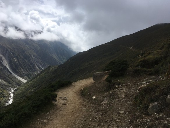
In this one day, we would descend 12,600 feet across approximately 25 miles. To cover the same distance coming up had taken us three days. At first, the trail was just as much a vertical drop as it had been a vertical ascent coming up. Stairs built for gods. The snow did not instill confidence in our footing. However, some hours later, we were practically galloping as the craggy trail gave way to grasslands and even, surprisingly, a high alpine sandy beach! My lungs ravenously gulped the oxygen-rich air as energy returned to every part of my body. At last, we could stop popping Diamox and drink beer and urinate like normal people.

Beach. Huh!
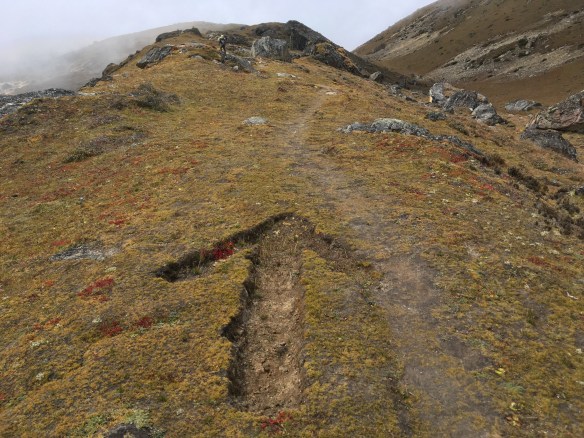
A few subtle clues along the way
Hello there! I’m a house!
Thame was a pleasant village, just a few tea houses and a great many yaks. It seems that Thame is like a truck stop for the yak caravans. Soon as we dropped our packs, we plopped down on the grassy slope and passed my flask of single malt around a circle of fellow adventurers. Some of them were heading up the way we had come down. I thought they were either insane or poorly informed. While our trek from Gokyo to the pass was excruciating, the reverse course would be far more punishing. I wonder if they made it.

Aw, baby yaks!
Just got a fresh paint job
A somewhat more relaxed pace.

Next day, we made it to Tengboche, birthplace of Everest summit pioneer Sherpa Tenzing Norgay. It was an idyllic setting, Buddhist stupas and the old familiar prayer stones alongside a rushing whitewater. We could’ve easily stayed the night, but we were sick to death of trail food. We wanted pizza and beer and that meant we’d hike the remaining miles down to Namche.

Every trekker in Nepal knows these menu items far too well.

This time, we did not leave it to Nopraj to find a hotel. We stayed at a far more accommodating lodge, similar to the one in Gokyo. Hot showers, good food. We browsed the souvenir stalls; Greer bought a Tibetan print for her sister and I bought a yak bell for my dog. Of course we popped back into the Irish bar. It was much busier now, as high season was starting to peak, and we saw the fresh faces of people who, like us only a week ago, believed they had just accomplished the most difficult climb of the trek. Naturally, we did our best to confirm the lie.
Returning to civilization!
Greer and I saddled up to the bar and ordered our first normal-tasting beer of the trip: a Khumbu Kolcsh. The bartender welcomed us back with a bowl of popcorn. Just then, a dirty, hippy-stink hand reached between us and grabbed a handful from the bowl. I looked up to see Mitch Hedburg, still drunk and worthless a week later. In a way, I was kind of glad to see him. It meant I was still alive.
Aside from a bit of up and down, the hike from Namche to Lukla is fairly uneventful, though quite long. On the way, we ran into Matthew, a friend from work. In the same number of days we had been on trail, he had managed to hike EBC plus the Three Passes (of which Renjo La is the easiest pass). My trek had been incredibly challenging, but he had narrowly avoided a rockslide. In my mind, this earns him the Wholly Hardcore prize.
With Matt and his guide, we became a party of five, and shlepped the rest of the way to Lukla. We confirmed our flights for the next morning (very important to do this) and checked into a quite nice lodge adjacent to the airport. At this point, we bid farewell to Nopraj, leaving him with a nice tip and letter of reference.
While we sipped Belgian beers and dined on pasta that didn’t taste like paper, we were joined in the restaurant by an assembly of representatives from the regional villages, dressed in traditional costume, who were holding some sort of conference to address local concerns. It made for fascinating eavesdropping, but we decided the nearby Irish bar (yes, another high-altitude Irish bar) would be a more suitable environment for continued drinking.
The next morning, our plane took off according to schedule. I could see Matt waving us goodbye from the platform overlooking the tarmac. I wondered if that would be the last wave goodbye I’d ever see, as the plane reached the end of the downward-sloping runway and briefly plummeted downwards into the abyss before catching its wind and pulling up.
In the grand tradition of Sam and Greer adventures, this one will be hard to top. We were pushed to our limits of physical endurance and politeness. We saw panoramic views from the top of the world, the Third Pole. And yes, safely back in Kathamandu, we did have that lovely rendezvous with our French Canadian friends, dining on Newari style buffalo brains and spinal cord. Whatever may come next, I only hope it will not involve dal baht and deep fried candy bars.
Final thoughts
I faced a few moral quandaries on this trek, one of them was the porter hire. On one hand, these guys work their asses off for a pittance. On the other hand, what they earn is the backbone of their economy. To us, $17 may not seem like an amazing day wage, but to them, it’s a fortune. Definitely more than what’s earned from one season of farming potatoes. And definitely easier than what cargo sherpas do — these fellows carry more than twice the weight up and down the same mountain passes, but for half the money.

These poor souls are on the same trek as us, but hauling window and door sets.
My takeaway?
- Economics and morality are more complicated than social media would have us believe.
- Never do yourself what you can afford to pay someone to do for you.
- No matter what you do for a living, sherpas work harder.
- Tip generously.
I hope that some of my readers are inspired to try this trek on their own one day. Speaking for myself, I cannot wait to return in a few years’ time and attempt the Three Passes, or maybe head Pokhara way and do the Annapurna circuit. Here are some practicalities to consider in your planning.
Costs:
Round-trip flights from the US or Europe start at about $1000. Greer made the mistake of booking flights with domestic connections in China and India. What Expedia doesn’t tell you is neither country offers a transit visa, nor do they offer tourist visas on arrival. You have to arrange ahead of time, and the visas aren’t cheap. Otherwise, you run into some real hassles at the airport, and possibly some severe delays.
It’s better to book with Qatar Airways, or another Middle Eastern airline — hassle-free layovers in much nicer airports. West Coasters might consider an East Asian carrier, but mind those connections, and avoid China Southern, unless you really hate yourself.
Accommodations range from free to cheap to mildly expensive. Here are the options for Kathmandu.
Free: Maybe you know someone. If not, maybe I can get you connected. Otherwise, there’s Couchsurfing.com, which I’ve used on many occasions to stay for free in cities from the US to Europe to Asia.
Cheap: The Thamel backpacker district offers hostels of varying quality and price. Having dropped into a few hostel parties over the years, I can testify that Thamel is a great place to meet fellow trekkers, and maybe see them again when you’re on trail. I can also testify that it’s full of hardcore hippies who maybe years ago came here planning to trek, but got permanently high and stayed idle instead. If you prefer privacy, AirBnB has good options. All in, you’re looking at five to fifty dollars a night.
Mildly expensive: The Hyatt is where I go to get away from the crazy of Kathmandu. Their pool is pretty nice, the grounds are beautifully landscaped, and the hotel itself features classical Newari architecture. It’s considered to be one of the nicest Category 1 Hyatts in the world. UNESCO site Boudhanath is a brief walk down the road. There are a handful of other similarly outfitted hotels in the city, as well as a few picturesque resorts in the hillsides. You can usually get in for under $100, especially if you book early.
Once on trail, the economic model is less straightforward.
Most tea houses are “free” but you’re required to eat in their restaurant. The menu is the same damn trail food, everywhere you go. It’s tiresome, and it’s crazy expensive. We’d usually spend five to ten dollars on a main, another five or ten on a thermos of tea, and on the rare occasion we drank beer, that was another five or ten. That can be fifty dollars or more for what’s basically two skinny mattresses in a cardboard shack, plus god awful trail food. To charge your gadgets, that could be another five or ten bucks. Alternatively, you can pay just $10 per night flat fee, but you need to figure out food on your own.
The larger trekker stops will offer nicer accommodations. Whether you eat in-house or not, a room starts at $25. With that you get your own hot-water shower and electrical socket.
Supplies:
A quick Google search for “gokyo trek supply list” will yield no shortage of results. Just how valid are these lists? Here’s the one I used, with [post-trek commentary] added. Everything here is easily acquired for rent or sale in Kathmandu, except where noted.
Important documents and items
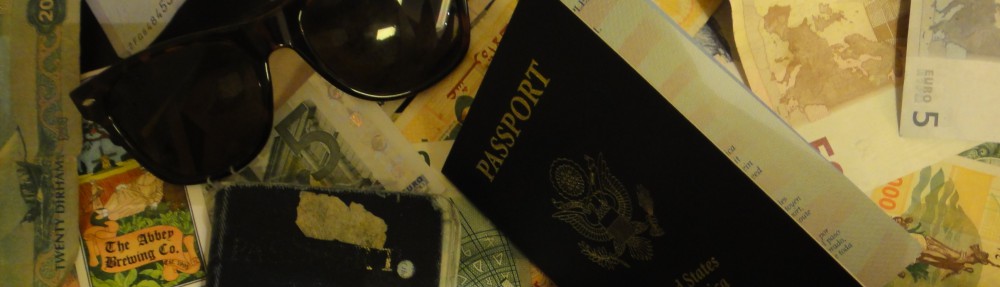
- Valid passport, 2 extra passport size photos, airline tickets [you’ll probably want a few extra photos, and they can be acquired more easily and cheaply in Kathmandu, catered to the specs required on the Khumbu park pass]
- Separate photocopies of passport, visa form (easily obtained at Kathmandu airport), proof of insurance [you can also register for your visa on Nepal’s cumbersome website, which saves time at immigration]
- Dollars, pounds or Euros in cash for purchasing Nepalese visa at Kathmandu airport, for paying for restaurants and hotels, for gratuities, snacks, and to purchase your own drinks and gifts [payment also possible by credit card, assuming their machine is working. there are a few ATMs at the airport, and their currency exchange counter is pretty legit.]
- Credit cards, Bank/ATM/Cash machine cards for withdrawing funds from cash machines [you may need to try several ATMs before finding one that works. Nabil and Himalayan Bank machines tend to work best. for using cash in country, I recommend you get local currency from ATMs — the airport has a few — and mindful of any bank fees back home, take out a lump sum. know that Nepali rupees are worthless outside of Nepal and cannot be exchanged once you leave. even in country, it can be hard to find someone willing to exchange your rupees with dollars. it’s kind of a pain.] (bring a photocopy of your cards), traveler’s checks, etc. [travelers checks? those still exist?]
Head
- Bandana or head scarf, also useful for dusty conditions [often referred to as a ‘buff’]
- Warm hat that covers your ears (wool or synthetic)
- Headlamp with extra batteries and bulbs [think: rechargeable]
- Sunglasses with UV protection [don’t cheap out on this with $2 Ray Ban knockoffs]
- Prescription sunglasses (if required)
Upper Body [you may find that upper and lower body items are best acquired as rentals, unless you do a fair amount of alpine hiking.]
- Polypropylene shirts (1 half sleeve and 2 long sleeves) [those fisherman-style shirts are especially good, as they breathe easily]
- Light and expedition weight thermal tops
- Fleece wind-stopper jacket or pullover [this was way more necessary than I predicted, especially on those cold nights around the dung fire]
- Waterproof (preferably breathable fabric) shell jacket [more compact the better]
- Down vest and/or jacket [vest is a better choice. again, very good for the cold nights.]
- Gore-Tex jacket with hood, waterproof and breathable [assuming you travel in spring or fall, this is a bit redundant if you already have the shell jacket]
Hands
- 1 pair of lightweight poly-liner gloves.
- 1 pair of lightweight wool or fleece gloves
- 1 pair of mittens, consists of 1 Gore-Tex over mitt matched with a very warm polar-fleece mitt liner (seasonal) [again, this is overkill in the spring and fall]
Lower Body
- Non-cotton underwear briefs [or else bring some cornstarch!]
- 1 pair of hiking shorts
- 1 pair of hiking trousers [better yet, bring one or two pairs of hiking trousers with removable legs]
- 1 pair of lightweight thermal bottoms (seasonal) [only had to use these once, but worth it!]
- 1 pair of fleece or woolen trousers [nah.]
- 1 pair of waterproof shell pants, breathable fabric [worth having, if only needed once]
Feet
- 2 pairs of thin, lightweight inner socks
- 2 pairs of heavy poly or wool socks [I just brought a bunch of poly-wool socks — they clean up real easy]
- 1 pair of Hiking boots with spare laces (sturdy soles, water resistant, ankle support, “broken in”) [please, please make sure you’ve worn them in — ideally, boots you’ve spent the last six to twelve months hiking in. and do get the spare shoelaces. I found they had many practical uses beyond shoes.]
- 1 pair of trainers or running shoes and/or sandals [Greer brought Crocs, which are bulky and ugly but highly desirable after you’ve kicked off the boots and want to lounge by the dung stove with your wool socks still on]
- Cotton socks (optional) [meh.]
- Gaiters (winter only), optional, “low” ankle high version [brought them, didn’t need them]
Sleeping
- 1 sleeping bag (good to -10 degrees C or 14 degrees F)
- Fleece sleeping bag liner (optional)
Rucksack and Travel Bags
- 1 medium rucksack (50-70 liters/3000-4500 cubic inches, can be used for an airplane carryon)
- 1 large duffel bag [I see no practical purpose for this, unless you want to leave non-necessities at the hostel]
- A small daypack/backpack for carrying your valuables, should have good shoulder padding [better yet, try a daypack with hydration bladder]
- Small padlocks for duffel-kit bags [really only necessary for hostels]
- 2 large waterproof rucksack covers (optional) [you may find your packs already have these installed]
Medical [get your meds in Nepal, where drugs are inexpensive but good quality]
- Small, personal first-aid kit. (simple and light)
- Aspirin, first-aid tape, and plasters (Band-Aids)
- 1 skin-blister repair kit
- Anti-diarrhea pills [oh yes definitely]
- Anti-headache pills
- Cough and/or cold medicine
- Anti-altitude sickness pills: Diamox or Acetylzolamide
- Stomach antibiotic: Ciprofloxacin, etc. Do not bring sleeping pills as they are a respiratory depressant.
- [probiotics are also good as a preventative medicine]
- Water purification tablets or water filter [I suggest you bring all three. tablets are simple yet effective, though your water will taste slightly of swimming pool. filters are very effective for silt and bacteria but don’t always eliminate viruses. UV wands kill all the microbes, but rely on battery power. I recommend a model like this, powered by a USB cable instead of removable, quick-to-die-in-cold-environments batteries. that charge-up will cost money in most tea houses, or you can charge it yourself with a portable solar panel. just avoid rinky-dink models like this one.]
- 1 set of earplugs [no — bring several sets. walls are thin and people snore. you’ll lose some along the way, and it’s nice to share extras with less prepared trekkers.]
- Extra pair of prescription glasses, contact lens supplies
Practical Items
- 1 small roll of repair tape, 1 sewing-repair kit [duct tape should have your bases covered]
- 1 cigarette lighter, 1 small box of matches [matches will only get wet and make you sad]
- 1 compass or GPS (optional)
- 1 alarm clock/watch [or, you know… your phone]
- 1 digital camera with extra cards and batteries [again, batteries die quick the higher you go.]
- Large Ziplocs [keep one for MOOP]
- 2 water bottles (1 liter each) [or better, a hydration pack]
- 1 small folding knife [bad assssss!]
- Binoculars (optional)
- 4 large, waterproof, disposable rubbish sacks
Toiletries
- 1 medium-sized quick drying towel
- Toothbrush/paste (preferably biodegradable)
- Multi-purpose soap (preferably biodegradable)
- Deodorant [oh really? you have a date after this? a job interview? leave the Speed Stick at home.]
- Nail clippers [god forbid your manicure gets tarnished]
- Face and body moisturizer
- Female hygiene products
- Small mirror [good for signaling the helicopter when you’re buried in an avalanche]
Personal Hygiene
- Wet wipes (baby wipes) [tea houses rarely have toilet paper, and these leave your bottom feeling clean and shiny.]
- Tissue /toilet roll [nah. redundant and bulky.]
- Anti-bacterial hand wash [big bottle!]
Extras/Luxuries
- Reading book [you can trade up books at some tea houses and cafés]
- Trail map/guide book [many trekker shops offer waterproof editions]
- Journal and pen [I kept entries on my iPhone]
- iPod [If you’re hiking solo. Otherwise, don’t be such an aloof jerk!]
- Travel game i.e. chess, backgammon, scrabble, playing cards (to help you pass the time at teahouses and/or camps) [Scrabble? that’s ambitious. stick with cards.]
- 1 modest swim suit [on this particular hike, there is no place to swim. maybe for the hotel?]
- Binoculars (optional) [keep it compact, but there’s some good bird watching on trail]
- Voltage converter (from 220 to 110) [highly impractical, unless you plan to bring along kitchen appliances. most US electronics are rated 110-220.]
- Plug adapter (2 round pegs to 2 flat pegs) [better yet, grab a universal adapter, easily acquired in Nepal. socket types in Nepal are totally inconsistent.]
- Lightweight pillow case (in case your teahouses provide you with pillows) or use your own stuff as a pillow [this is actually a necessity. tea houses rarely wash the linens.]
